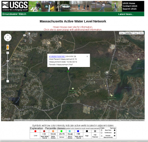
 How is it that I, a mere mortal, can get up on a Sunday morning and without so much as finishing my tea or getting out of my jammies, find information like this. The first picture shows a USGS monitoring well not very far from the Tribe’s new Community Center. It shows a recent (October 30) groundwater level at 9 feet ASL. If there is water in the basement, did our engineers consult this well?
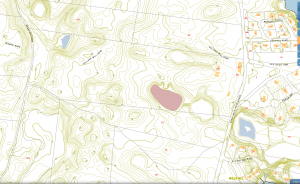
The next picture is from the Town of Mashpee GIS website. It confirms, by the contours shown and the elevations of the open water and swamp nearby, the elevations of the water table and the area around the new building. It also shows the area behind the old building at about 14′ elevation. I don’t know the depth of the foundation, but the difference is pretty close. Also note that compaction the soil over a close water table can draw water above the surrounding levels, similar to soil liquefaction during an earthquake.
Normally, I would say that mistakes happen, that’s why pencils have erasers. The history of actions (and inaction) of the Cromwell administration, however, make me skeptical. Who is responsible, who signed off on the construction? We may never know, unless there is a competent and probing investigation of the whole matter.
Click on either picture to enlarge.

